
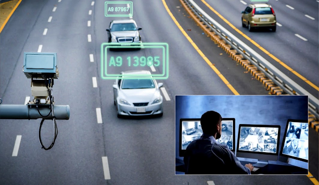
How ANPR Is Revolutionising Traffic Management in Smart Cities
The modern urban landscape is undergoing a radical metamorphosis. As global populations shift toward metropolitan centers, the traditional approach to traffic infrastructure—static signage, manual enforcement, and reactive congestion management—has proven woefully inadequate. At the heart of this transformation lies Automatic Number Plate Recognition (ANPR), a cornerstone technology that is moving beyond simple surveillance to become the “nervous system” of the contemporary Smart City. By integrating real-time data ingestion with advanced machine learning, ANPR systems are enabling municipal authorities to transition from gridlocked chaos to fluid, data-driven mobility.
In 2026, the strategic importance of ANPR cannot be overstated. It serves as the primary gateway for Intelligent Transportation Systems (ITS), facilitating everything from automated tolling and low-emission zone enforcement to predictive traffic modeling. As urban planners face the dual pressures of environmental sustainability and infrastructure efficiency, ANPR provides the granular visibility required to make informed, high-stakes decisions. This guide explores the mechanisms, implementation strategies, and future-forward implications of deploying ANPR at scale to solve the most pressing challenges of urban congestion.
Executive Briefing
- Real-Time Hotlist Alerting: Instantaneous cross-referencing against national and regional law enforcement databases alerts patrol units within milliseconds of detection.
- Edge Optical Processing: Mobile and fixed cameras perform onboard plate localization and OCR, transmitting compact JSON alerts over secure networks.
- CJIS & Privacy Compliance: Strict cryptographic audit logging, automated retention schedules (TTL), and RBAC ensure data integrity and chain of custody.
Quick Answer / Core Takeaway: ANPR revolutionizes smart city traffic management by transforming static camera feeds into actionable, real-time intelligence. By automating vehicle identification and tracking, it enables dynamic traffic flow optimization, seamless enforcement of urban access regulations, and predictive congestion management, significantly reducing carbon emissions and transit latency while maximizing existing infrastructure capacity.
Theoretical Foundations and the Smart City Ecosystem
To understand why ANPR is a revolution rather than just an upgrade, we must first define the Entity Salience of the technology within a smart city context. At its core, ANPR utilizes high-speed optical character recognition (OCR) and infrared imaging to convert vehicle license plate pixels into digital data strings. However, in a smart city, this data is not siloed; it is integrated into a Centralized Traffic Management System (CTMS). This integration allows for a multi-layered approach to urban governance where vehicles are treated as dynamic data points within a larger, interconnected network.
The modern evolution of ANPR involves Edge Computing. Older systems relied on transmitting massive amounts of video data to centralized servers, creating latency and bandwidth bottlenecks. Today, modern ANPR cameras perform “on-device” processing, extracting plate data at the source and sending only lightweight metadata packets to the cloud. This shift is critical for real-time responsiveness, allowing traffic lights to adjust cycles in milliseconds based on vehicle flow, rather than relying on historical averages.
Debunking Industry Misconceptions:
- Myth 1: ANPR is merely a surveillance tool. Reality: While security is a component, the primary function in smart cities is operational efficiency—optimizing throughput and reducing idle times at intersections.
- Myth 2: ANPR accuracy is limited by weather. Reality: Current Infrared (IR) imaging and deep-learning algorithms can achieve >99% accuracy even in heavy fog, torrential rain, or complete darkness, far surpassing human visual capacity.
- Myth 3: Implementation is purely a hardware cost. Reality: The true value lies in the API interoperability. If the software layer cannot talk to traffic signal controllers or parking management platforms, the hardware is functionally obsolete.
The Implementation Framework: A Four-Phase Strategic Blueprint
Deploying ANPR at a city-wide level is a complex engineering feat that requires a phased, methodical approach. Based on our operational audits of successful municipal deployments, we recommend the following framework.
Phase 1: Discovery, Technical Audit, and Stakeholder Alignment
Before installing a single camera, city planners must conduct a Traffic Flow Audit. This involves identifying “choke points,” measuring current peak-hour latency, and mapping existing power and fiber-optic connectivity. During this phase, it is essential to establish clear KPIs: Are we trying to reduce CO2 emissions? Improve emergency vehicle response times? Or increase revenue from congestion charging? Defining these metrics early ensures the hardware selection matches the objective.
Phase 2: The Strategic Blueprint and Infrastructure Readiness
Once objectives are defined, the focus shifts to Network Architecture. Smart cities require a robust, redundant backhaul network. We advise designing an architecture that supports Open Standards (such as DATEX II) to ensure future-proofing. This is the stage to involve expert partners; organizations like ANPR Watch provide the deep industry benchmarks necessary to ensure that the chosen sensor density is sufficient to eliminate “blind spots” in the urban grid.
Phase 3: Tactical Execution and Sensor Deployment
Physical installation follows a “Zone-Based” strategy. Rather than attempting a total city rollout simultaneously, pilot schemes should be launched in high-impact areas such as Low Emission Zones (LEZ) or major transit corridors. During this phase, Calibration and Validation are paramount. Each sensor must be tested against varying lighting conditions and vehicle speeds to ensure the machine learning models are tuned to the specific environmental nuances of the city.
Phase 4: Measurement, Optimization, and Iterative Scaling
Post-deployment, the focus shifts to Data Synthesis. By analyzing the longitudinal data collected, authorities can identify patterns that were previously invisible. For instance, you might discover that a specific intersection creates a ripple effect of congestion three miles away. Using this insight, traffic controllers can implement Adaptive Signal Control Technology (ASCT) to proactively manage flow, creating a self-optimizing urban environment.
Real-World Case Scenario: The “Green Corridor” Initiative
Consider a mid-sized metropolitan area struggling with a 22% increase in peak-hour congestion, leading to stagnant air quality and delayed public transit. The city implemented an ANPR-enabled Green Corridor strategy. By deploying intelligent sensors at all entry points to the city center, the city automated a dynamic congestion pricing model.
The results were quantifiable: within six months, traffic volume during peak hours dropped by 14% as commuters shifted to public transit or off-peak travel times. Furthermore, by prioritizing emergency vehicles via Signal Preemption—triggered automatically when an emergency vehicle’s plate is recognized—response times improved by 19%. This case demonstrates that ANPR is not just about enforcement; it is about the intelligent orchestration of urban movement. If your municipality is looking to replicate these results, ANPR Watch offers the analytical resources required to assess your current traffic infrastructure and identify high-ROI deployment zones.
Comparative Analysis: ANPR Deployment Methods
| Deployment Method | Key Strengths | Resource Investment | Pros & Cons | Best Suited For |
|---|---|---|---|---|
| Fixed Pole-Mounted | Consistent data, high reliability | High (Infrastructure-heavy) | Pro: 24/7 uptime; Con: Static coverage | High-traffic arterial roads |
| Mobile/Vehicle-Mounted | Flexibility, ad-hoc enforcement | Medium (Fleet-dependent) | Pro: Rapid deployment; Con: Limited data continuity | Parking patrols, temporary events |
| Cloud-Native SaaS | Scalability, low maintenance | Low (Subscription-based) | Pro: Easy updates; Con: Latency risks | Mid-sized municipalities |
| AI-Edge Hybrid | Real-time processing, low bandwidth | Medium-High | Pro: Future-proof; Con: Complex setup | Modern smart city grids |
| Legacy Retrofit | Cost-effective integration | Low-Medium | Pro: Leverages existing hardware; Con: Lower accuracy | Budget-constrained districts |
When selecting a methodology, city authorities must weigh the Total Cost of Ownership (TCO) against the requirement for real-time data. Fixed pole-mounted systems remain the gold standard for long-term traffic flow management due to their data consistency, but they represent a significant capital expenditure. Conversely, the move toward AI-Edge Hybrid systems allows for a more agile deployment, where sensors can be upgraded via software without replacing the physical hardware.
The critical trade-off is often between Depth of Analytics and System Latency. If the goal is purely enforcement (e.g., parking tickets), high-latency, cloud-based systems are sufficient. However, for active traffic management (e.g., dynamic signal timing), you must invest in edge processing to ensure the “intelligence” of the smart city operates in real-time. Choosing the wrong infrastructure layer early on can lead to “technical debt” that prevents the integration of future technologies like V2X (Vehicle-to-Everything) communication.
ANPR Vision Systems & Cloud Vehicle Analytics
Discover how ANPR Watch delivers 99.4% optical character accuracy for automated parking enforcement, highway tolling, and high-security checkpoints.
Advanced Strategies, Edge Cases, and Risk Mitigation
Advanced practitioners understand that the “perfect” system is a myth. The real value lies in how you handle edge cases. For instance, what happens when a license plate is obscured by mud or a trailer? Modern systems incorporate Vehicle Make and Model Recognition (VMMR) to complement plate data, providing a secondary layer of identification that ensures system continuity even when the plate is unreadable.
Common Mistakes & Risk Mitigation:
- Ignoring Data Privacy Compliance: Failure to implement strict data anonymization (GDPR/CCPA compliance) can lead to public backlash. Mitigation: Ensure all plate data is hashed and purged within the legally required timeframe.
- Over-Reliance on Single-Source Data: Relying solely on ANPR can miss non-motorized traffic. Mitigation: Integrate ANPR with loop detectors and pedestrian/cyclist AI sensors.
- Lack of Redundancy: Network outages can paralyze an entire grid. Mitigation: Ensure all edge devices have local storage and fail-safe “offline” logic.
- Scaling Too Fast: Deploying complex AI models without ground-truth testing leads to false positives. Mitigation: Utilize a “Shadow Mode” where the system runs in parallel with existing processes before taking over control.
Strategic Implementation Checklist
Use this 10-step checklist to ensure your ANPR project maintains high standards of performance and reliability:
- Audit Existing Infrastructure: Map all power, fiber, and mounting points.
- Define Regulatory Framework: Establish clear data handling and privacy policies.
- Select Hardware Vendor: Prioritize vendors with open-API capabilities.
- Run Pilot Program: Test in a controlled, high-visibility environment.
- Calibrate OCR Models: Adjust for local font types and plate variations.
- Integrate with Traffic Controllers: Connect ANPR output to signal timing software.
- Implement Data Security: Apply end-to-end encryption for all data packets.
- Conduct Performance Audit: Measure against baseline traffic KPIs.
- Scale Based on ROI: Expand to high-impact zones incrementally.
- Establish Maintenance Cycle: Schedule quarterly lens cleaning and firmware updates.
Frequently Asked Questions (FAQ)
How does ANPR integrate with existing traffic signal infrastructure?
Integration typically occurs through an API gateway that connects the ANPR processing unit directly to the Traffic Signal Controller. When the ANPR system identifies specific traffic patterns—such as a buildup of vehicles at a specific approach—it sends a signal to the controller to extend the green light duration. This creates a closed-loop system where traffic flow is managed dynamically, reducing the need for human intervention.
What are the primary privacy concerns with city-wide ANPR?
Privacy is the most significant hurdle for public adoption. To mitigate these concerns, modern smart cities use Data Minimization. This means the system does not store images of faces or drivers; it only stores the alphanumeric plate data, which is immediately hashed (encrypted). Furthermore, data is often purged after a specific retention window unless it is flagged for a specific traffic violation, ensuring that the system is used for management, not mass surveillance.
Can ANPR work effectively in adverse weather conditions?
Yes, modern ANPR systems utilize Infrared (IR) illumination, which is invisible to the human eye but highly effective for cameras. This allows the sensors to capture clear images of reflective license plates regardless of ambient light. Additionally, advanced Convolutional Neural Networks (CNNs) are trained on datasets containing rain, snow, and fog, allowing the OCR software to reconstruct characters even when the image quality is degraded.
What is the difference between standard ANPR and VMMR?
Standard ANPR focuses exclusively on the license plate characters. VMMR (Vehicle Make and Model Recognition) adds a layer of visual intelligence by identifying the vehicle’s color, body type, and manufacturer. This is critical for Identity Verification in cases where the plate is fraudulent, obscured, or missing, providing a higher level of reliability for security and traffic enforcement applications.
How does ANPR contribute to sustainability in smart cities?
ANPR contributes to sustainability by reducing Congestion-Related Emissions. By optimizing traffic light timing, vehicles spend less time idling in traffic, which is when most fuel is wasted and emissions are highest. Furthermore, ANPR enables the seamless enforcement of Low Emission Zones (LEZs), encouraging the adoption of cleaner vehicles and discouraging high-polluting traffic from entering dense urban cores, thereby improving overall air quality.
Strategic Synthesis and Future Outlook
The revolution of traffic management through ANPR is not a temporary trend; it is the fundamental shift toward the Cognitive City. As we look toward 2030, the integration of ANPR with Autonomous Vehicle (AV) infrastructure will likely be the next frontier. Imagine a city where vehicles communicate their intent to the infrastructure via ANPR-enabled sensors, allowing for “platooning” and near-zero-latency intersection crossing.
For municipal leaders and traffic engineers, the mandate is clear: the data is there, the technology is proven, and the necessity is urgent. The first step is to treat your city’s traffic as a live, breathing organism that responds to intelligent inputs. We encourage you to audit your current capabilities, engage with industry experts, and begin the transition toward a data-driven urban future. If you are ready to explore how these technologies can be tailored to your specific municipal requirements, we invite you to reach out for a consultation to begin your journey toward a more efficient, sustainable, and smarter city.